I+D+i
Developing of a methodology for the analysis and mapping of tranquility at territorial level
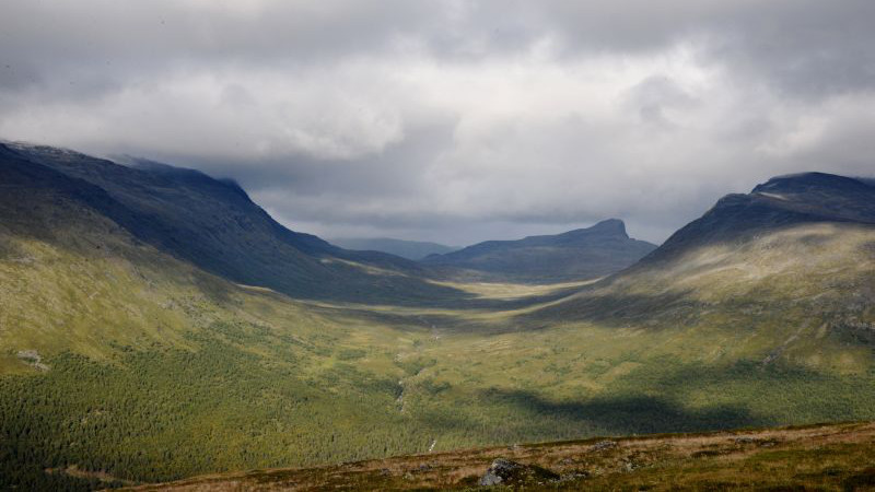
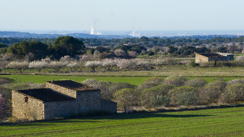

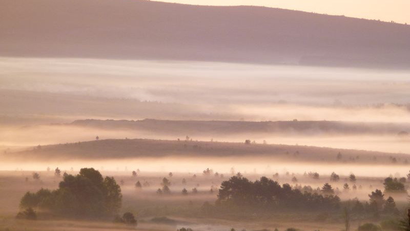
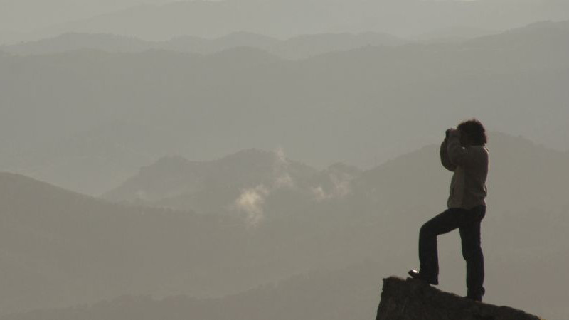
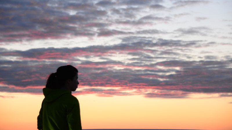
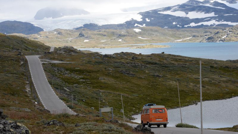
Tranquility is an ancient and everyday concept which can be defined as a mood of peace or harmony or, in other words, free from concern. And it is also an increasingly scarce good in the context of modern societies. Currently, as a result of a busy life, a growing part of the population considers tranquility –either consciously or not- as a basic component -even the most important one-, in decisions relating to the consumption of tourism and leisure products. In other words, we consume tranquility and so ethereal concept is on track to become one of the main arguments of the offers in the touristic and residential areas. However, only recently tranquility has begun to be regarded as one of the essential ingredients of the landscape - and, therefore, of the welfare of people (Nogué et al., 2008) - which explains why there is no reference to this issue in the European Landscape Convention signed in Florence in 2000.
Despite the interest aroused by tranquility, until recently it had not been addressed analytically. Quantification of tranquility is not an easy task because, in fact, the feeling of tranquility comes from a psychological state that depends on many variables, both external (noise, crowds, visual intrusion of infrastructure,...) and internal (mood, preconceived stereotypes, ...). While the former are often susceptible to evaluation, at least in semi-quantitative terms, the latter are hardly affordable. In any case, the tranquility is today an intangible but precious value, claimed in speeches that appeal to the land naturalness as an irreplaceable and threatened element which lays on the basis of our life quality. However, the difficulty in addressing its analysis and modeling its geographical behavior, has not yet allowed to integrate it in the processes of land planning, protection of natural areas, or impact assessment procedures.
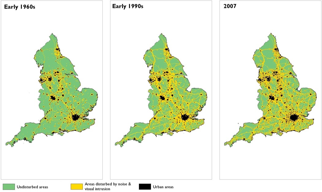
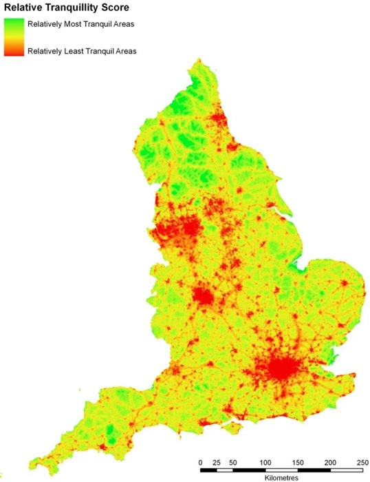
The idea of measuring the tranquility born in the UK, a country where urban, rural and natural areas are highly intertwined and where the task to reconcile the socio-economic growth with the right to enjoy tranquil places has become urgent. Already in the early 1990s, the Countryside Commission and the Council for the Protection of Rural England (CPRE) promoted the mapping of quiet areas to the apparent profusion of urbanization and infrastructure. This idea evolved from a former qualitative concept based on differentiation between tranquil and noisy areas (Bell, 1999; Land Use Consultants, 2007) to a fairly sophisticated method of continuous quantitative character, taking advantage of the advent of geographic information systems (MacFarlane et al., 2005; Jackson et al, 2008). While the latter offers a much more precise picture about the tranquility level of the different parts of the country, the approach is long, complex and therefore expensive.
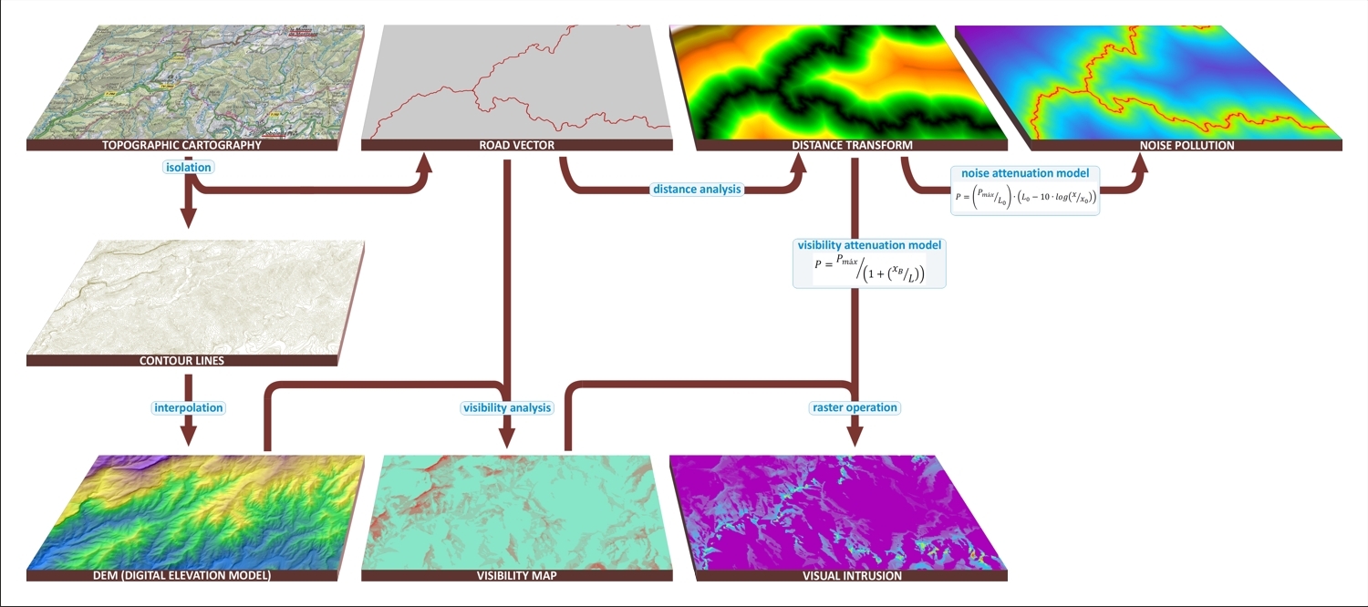
MN Consultors in Conservation Sciences started in 2009 a research with the aim of developing a fast, objective, scalable and reproducible methodology for the territorial analysis of tranquility, without endangering the flexibility required to make it adaptable to different contexts that occur in our environment nowadays. It is based on the following premises (see diagram):
- It should combine an approach to tranquility accurate enough with a reasonable investment in time and human and material resources.
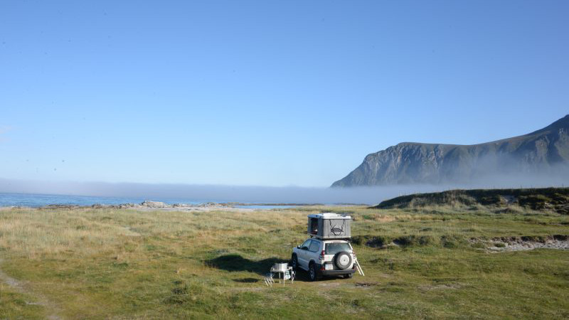
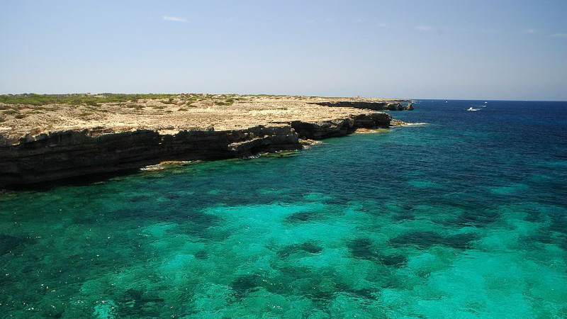
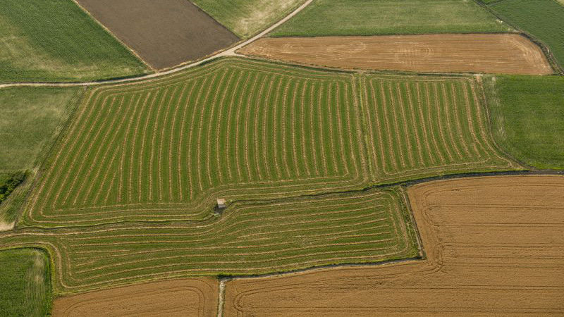
- All natural environments undisturbed by the anthropic action are seen equally tranquil, regardless of its aesthetic or symbolic value (agricultural environments, however, are considered also tranquil because our society perceives crops as characteristic landscapes of the natural / rural environment).
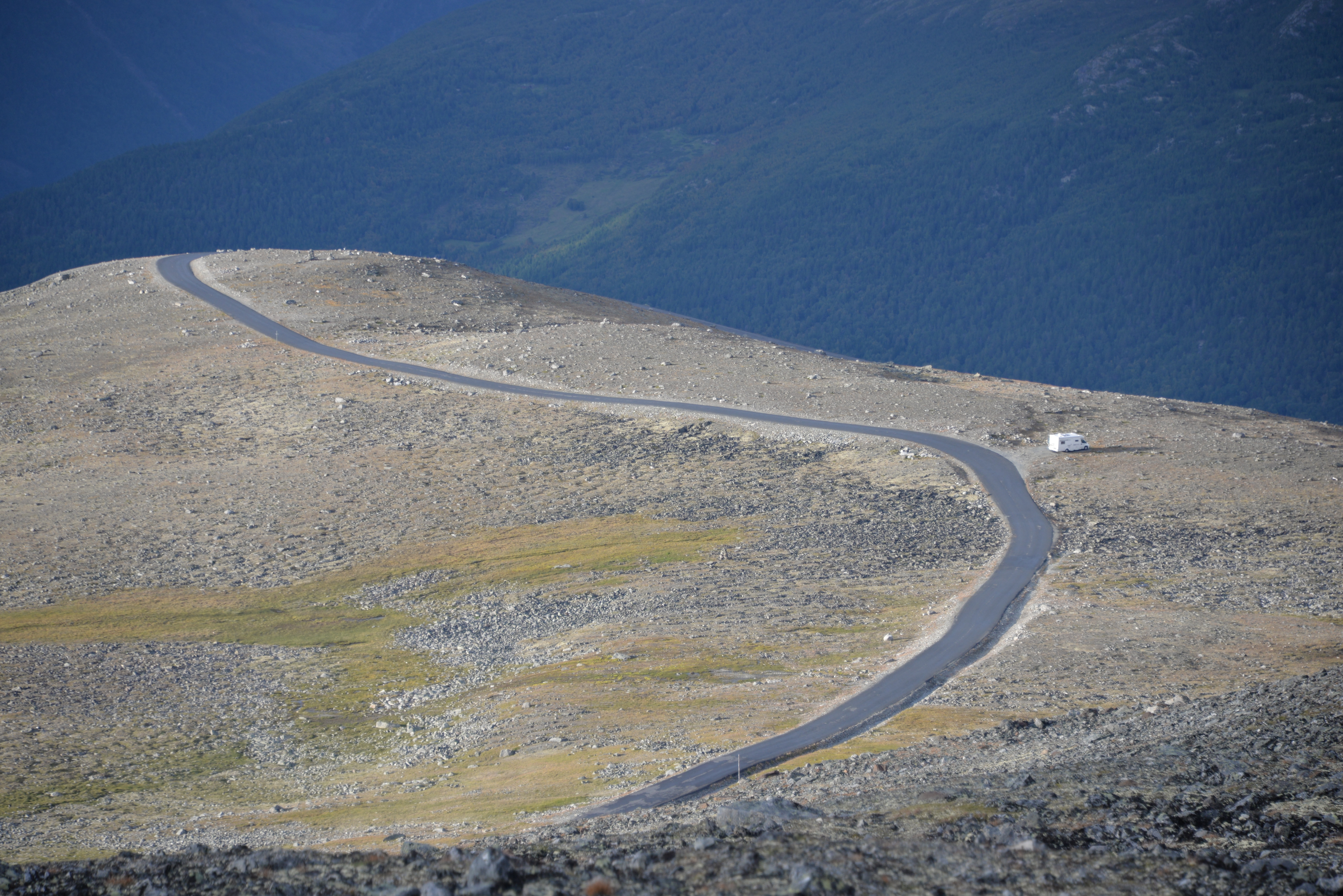
- Factors that disturb tranquility are related to the intrusion of human activities. In other words, the decline of tranquility in a given environment comes from anthropic disturbances of its "natural" state, not from its individual features.
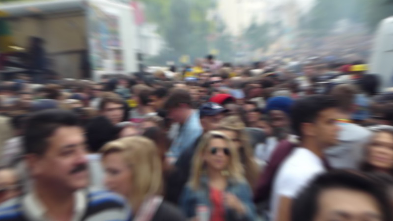
- Factors that alter or disturb tranquility (disturbance factors), are organized into three basic categories: 1) visual intrusion; 2) noise and 3) human presence (crowds). Additional sensory disturbance factors such as light pollution (night skyglow) or the odoriferous intrusion can also be considered.
- Disturbance intensity of each of the factors results from a combination of the effect caused by all vectors which influence them. A vector (roads, towns, ...) can affect more than one disturbance factor.
- The relative significance of each vector is not assessed from the opinions of the population, but from measurable objective features.
Regarding the methodology described in detail by Jackson et al., the main differences can be summarized in two fundamental ways: a) factors favoring tranquility are not considered, in consistency with the premise that all “natural” environments are equally quiet b) the relative importance of each vector is not defined from the opinions of a population sample, but from its measurable objective features. On the basis of this conceptual approach and the underlying assumptions involved, in recent years we have worked in the development of appropriate methodologies to model the effects of different vectors and in the adjustment of algorithms and mathematical expressions that allow the calculation and continuous rasterization of impacts at spatial level.
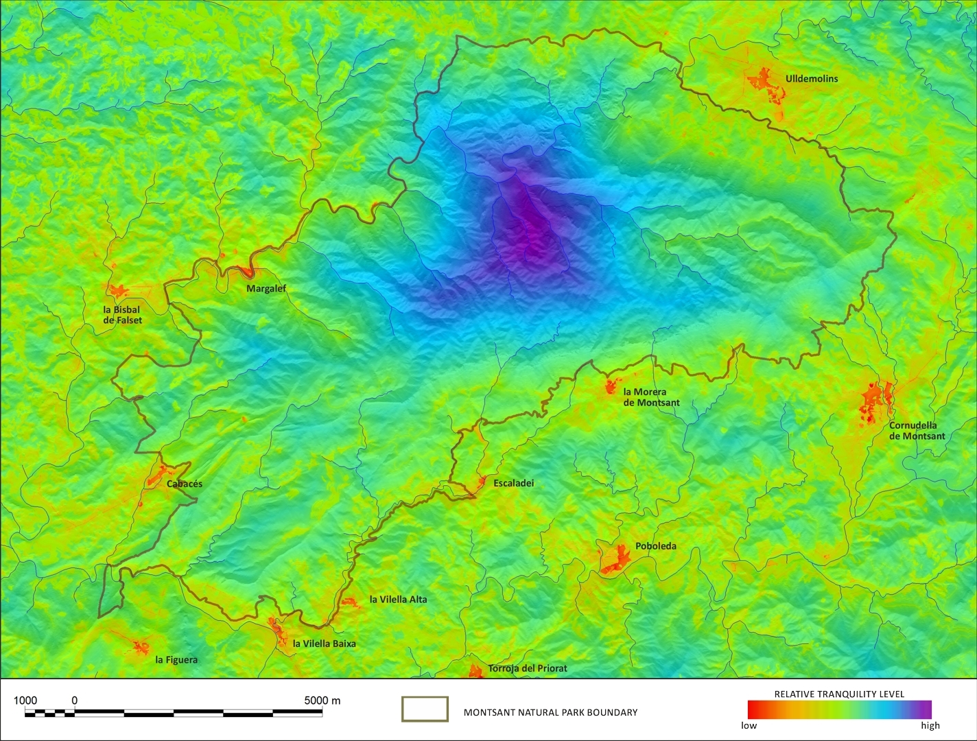
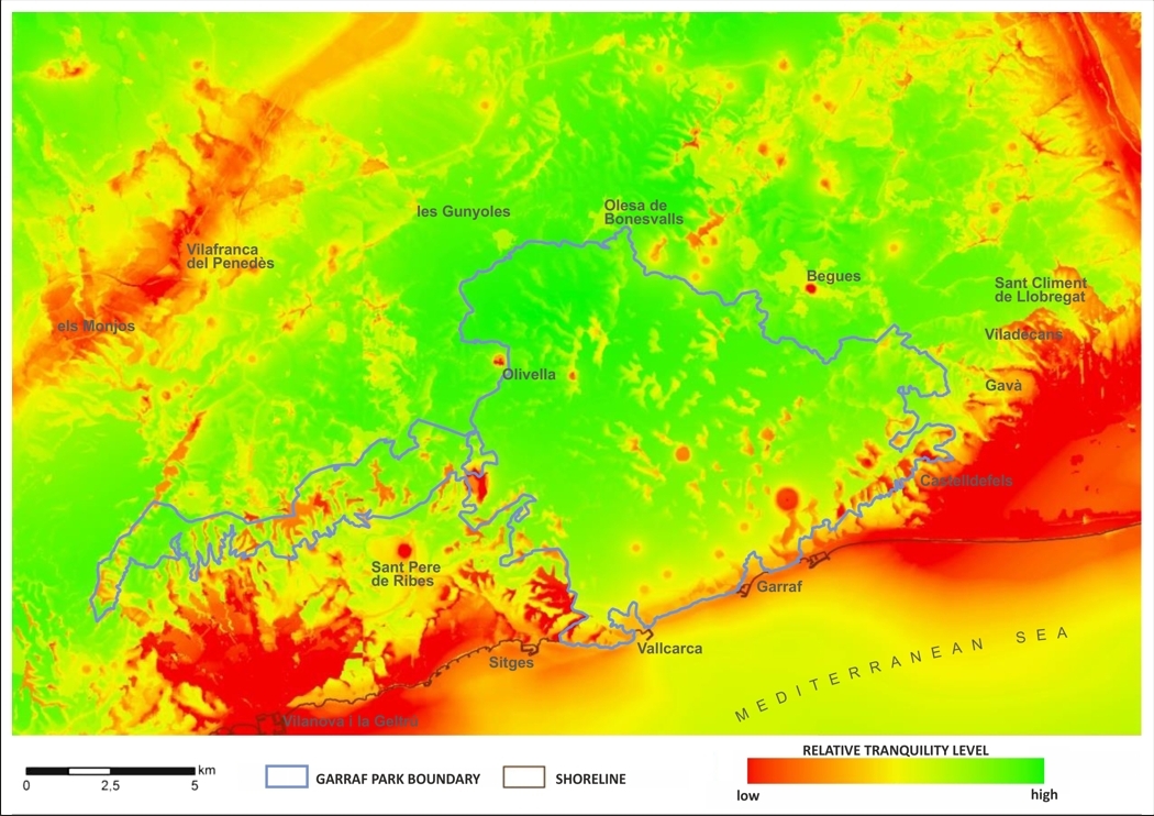
This idea and the methodology which develops it was experimentally applied in the framework of the Special Plan for the protection of the natural environment and landscape of the Serra de Montsant (Mallarach et al., 2012; MN Consultors, 2010). Thus, Montsant has become the first natural area where tranquility has been underlined as one of the outstanding strategic values to be protected and has been mapped in an unprecedented resolution (25 m2/pixel). Subsequently, under a collaboration with the University of Zaragoza, MN Consultants co-directed a work where a more evolved version of the method is developed in Garraf Natural Park (Giménez, 2013), an area with strong contrasts concerning tranquility, which required further adjustments of the model to fit a wider range of situations. MN is currently working on improving this methodological approach and its implementation at regional level.
References
Bell, S. (1999). Tranquility mapping as an aid to forest planning. Forestry Commission, Edinburgh (Scotland).
Fuller, D., Haggett, C. & Dunsford, H. (2008). Paisatge, Tranquil·litat i salut. In: Paisatge i Salut (Plecs de Paisatge. Reflexions ; 1), 311-334. Observatori del Paisatge de Catalunya (Olot) i Departament de Salut de la Generalitat de Catalunya (Barcelona).
Giménez, I. (2013). Estudio de la tranquilidad en el Parque Natural del Garraf. Dir. Pascual, R. y de la Riva, J. Máster en tecnologías de la información geográfica para la ordenación del territorio: sistemas de información geográfica y teledetección. Departamento de Geografía y Ordenación del Territorio (Universidad de Zaragoza).
Jackson, S., Fuller, D., Dunsford, H., Mowbray, R., Hext, S., MacFarlane R. & Haggett, C. (2008). Tranquillity Mapping: developing a robust methodology for planning support. Report to the Campaign to Protect Rural England, Centre for Environmental & Spatial Analysis, Northumbria University, Bluespace environments and the University of Newcastle upon Tyne.
Land Use Consultants (2007). Developing an intrusion map of England. Campaign to Protect Rural England, (CPRE), London.
MacFarlane, R., Hagget, C. & Fuller, D. (2005). Mapping Tranquility. Defining and assessing a valuable resource. Campaign to Protect Rural England (CPRE), London.
Mallarach, J.M, Comas, E., & de Armas, A. (2012). El patrimonio inmaterial: valores culturales y espirituales. Manual para su incorporación en las áreas protegidas. Manual 10; Serie de manuales EUROPARC-España. Ed. Fundación Fernando González Bernáldez. Madrid.
MN Consultors en Ciències de la Conservació (2010). Avaluació de la tranquil·litat a l'ENP Serra de Montsant. Pla especial de protecció del medi natural i el paisatge de la Serra de Montsant. Generalitat de Catalunya [en trámite].
Nogué, J., Puigbert, L. & Bretcha, eds. (2008). Paisatge i Salut (Plecs de Paisatge. Reflexions ; 1). Observatori del Paisatge de Catalunya (Olot) i Departament de Salut de la Generalitat de Catalunya (Barcelona).
To cite this reference
Pascual Garsaball, R.; Giménez Anaya, I; Cadiach Ricomà, O.; García-Pérez, G.; Solé Herce, J. (2014). Development of a methodology for the analysis and mapping of tranquility at territorial level.
Retrieved from MN Consultors Website [28 Jan. 2015].
URL: http://www.mnconsultors.com/idi/development-of-a-methodology-for-the-analysis-and-mapping-of-tranquility-at-territorial-level/lang/en